Feature
Budget questions: ask what people would give up
Participatory budgetingPublic consultation
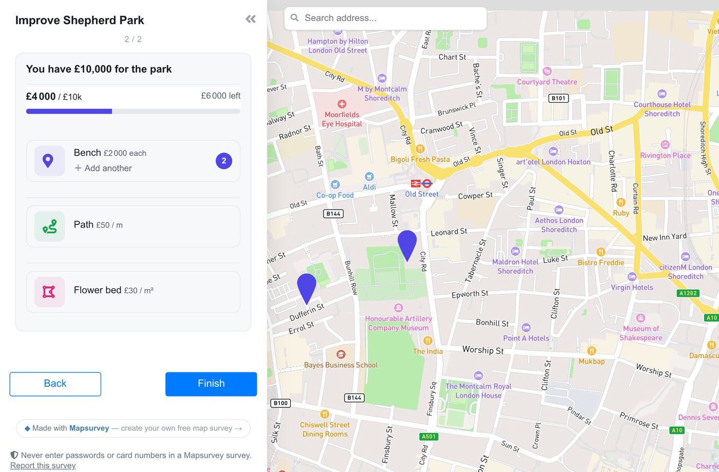
A new question type and a budget on a group of map questions. Residents split a fixed sum between priorities, fund projects until the money runs out, or place benches, paths and flower beds on the map against a budget.
Councils that run a budget or precept consultation on Mapsurvey were building it from ranking questions: put parks, safety and youth services in order. A ranking tells you what matters to people. It does not tell you what they would give up, because nothing on the list costs anything.
Budget questions add the missing constraint. There is a fixed amount, every choice takes some of it, and the survey will not move on until the respondent has decided where the money goes.
Three ways to ask
Split a budget
You give a total — £2M, 100 points, or 100% — and a list of priorities. The respondent moves each amount up or down in steps you choose, and a bar at the top fills in the items' colours, so they always see what is left. You decide whether the whole budget must be allocated or only up to it; Next waits until the rule is met.
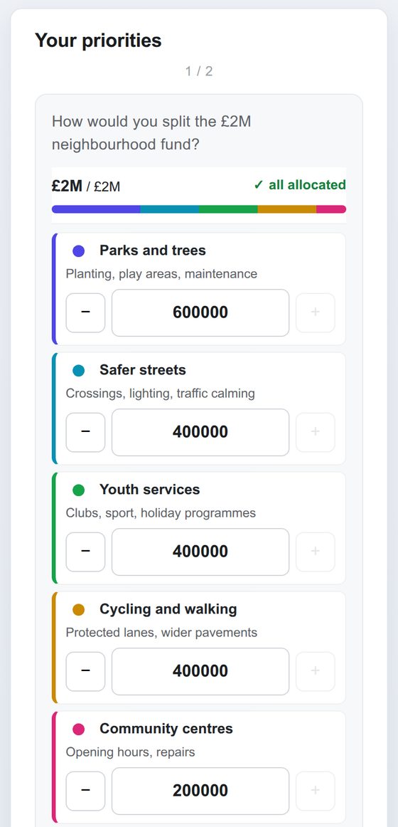
In the results you get the average share of the budget per item: the number a cabinet report needs, and one that moves when you take something away.
Choose projects within a budget
Each item has a cost. Respondents tick projects until the money runs out; a project dearer than what is left greys out and says by how much. Results show the share of respondents who funded each project and the most supported set that fits the budget together. The projects can also be objects of a map layer, so each one sits where it would be built (that option is part of Pro).
A budget on a group of map questions
This one needs a map. Put ordinary map questions in a group, give the group a total, and give each question a price: a bench £2,000 each, a path £50 a metre, a flower bed £30 a square metre. Respondents place marks the way they always do, and the budget decides how many fit.
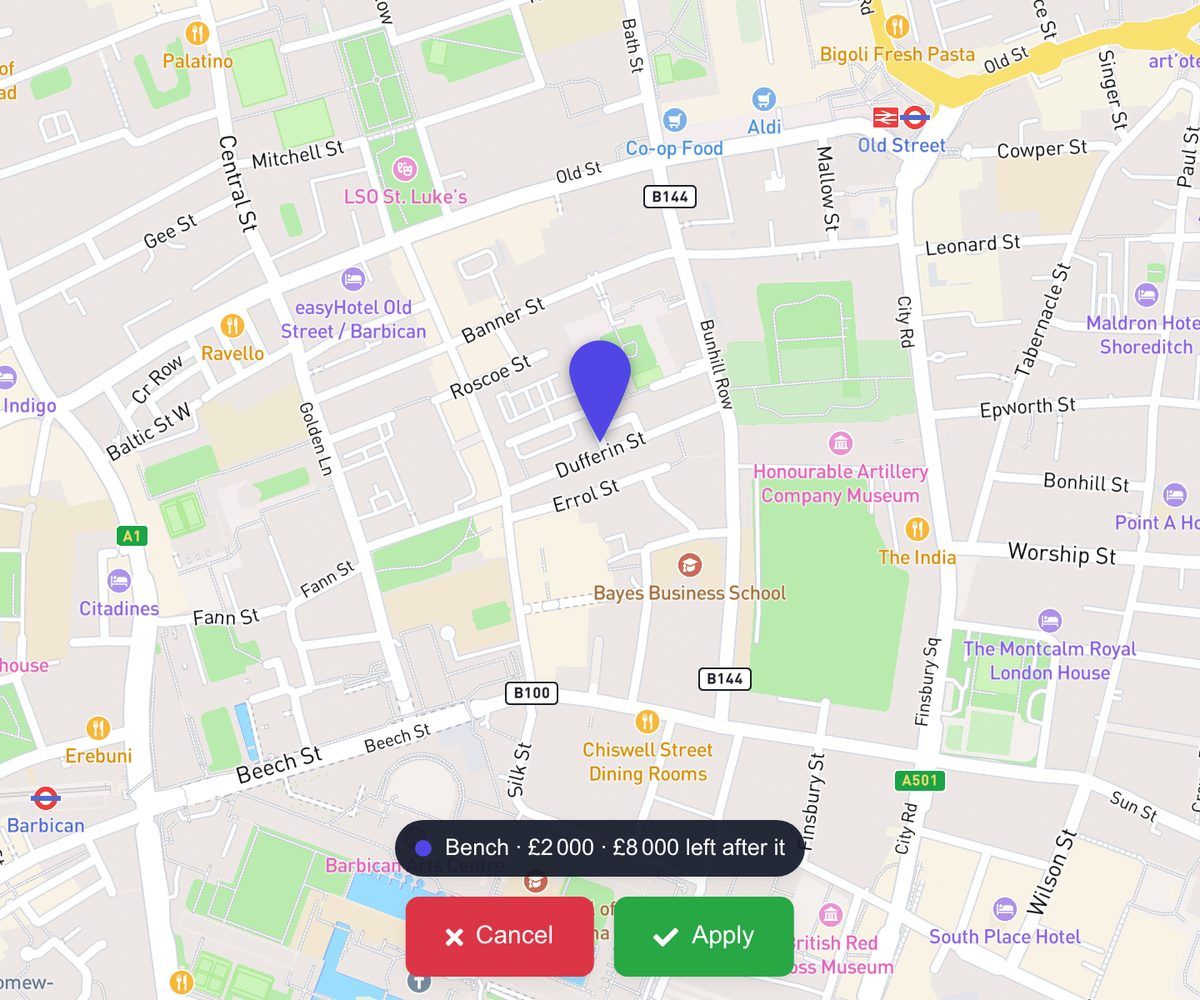
Before a mark goes down, the label says what it costs and what will be left. A route drawn too long or an area drawn too large is refused with what it would have cost. Sub-questions, minimum and maximum marks and tap-to-place work as before, because the questions are the same map questions with a price on them.
Responses show the marks, metres or square metres per question, what they cost and the share
of spend, and the marks themselves on the map. In the GeoJSON, GeoPackage, Shapefile and KML
exports every priced mark carries its cost, and each respondent's row has what they
spent.
Where it fits
Participatory budgeting rounds, precept and council-tax consultations, a park redesign with a fixed capital sum, a ward fund. Anywhere the honest answer to "what do you want?" is "everything", and the question you actually need answered is what comes first when there is not enough.
Split and projects work in any section; a budget group needs a map section. Everything is free except projects taken from a map layer. The steps are in the help centre: Ask how to spend a budget. For how Mapsurvey handles a whole participatory budgeting process, see participatory budgeting.
Try it on your next consultation
Draw your area, write your questions and share one link. Free to start.
Create your map survey