Baltimore, Maryland · Neighborhood planning
Remington residents map their neighborhood plan
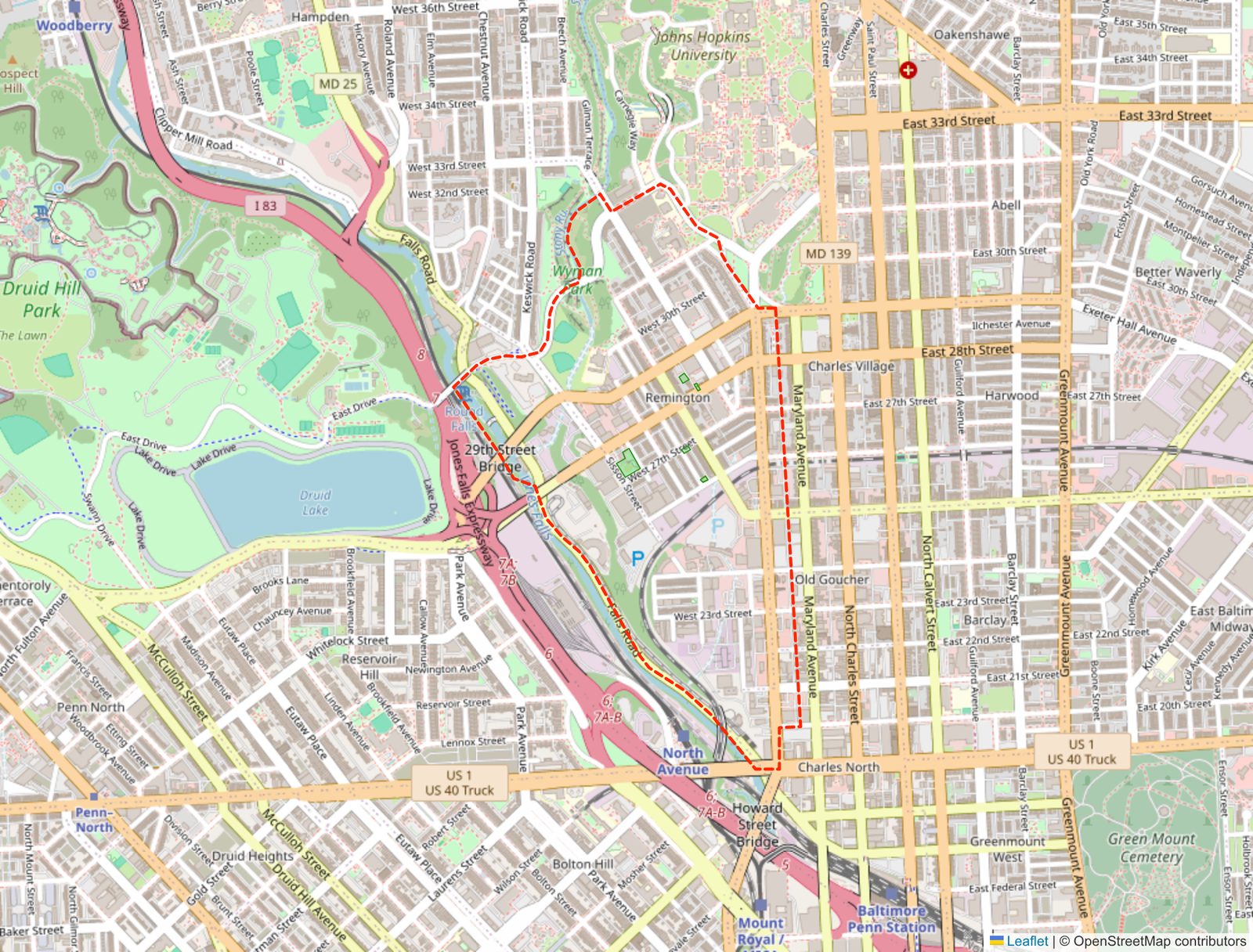
Remington, a Baltimore neighborhood of row homes between Johns Hopkins and the Jones Falls, is updating its community plan. Before the planners drew anything, residents marked the map.
 Greater Remington Improvement AssociationRemington Neighborhood Plan Update, survey by Unknown Studio
Case study · October 2026
Greater Remington Improvement AssociationRemington Neighborhood Plan Update, survey by Unknown Studio
Case study · October 2026
A neighborhood updates its plan
Remington sits between the Johns Hopkins campus and the Jones Falls valley, a neighborhood of row houses that has changed a lot since its residents wrote their last plan in 2017. The Greater Remington Improvement Association (GRIA) is updating that plan for the next ten years. Unknown Studio, a Baltimore landscape architecture and urban design practice, leads the work with Present Company and Kittelson & Associates, and built the survey.
The goal
Remington's last neighborhood plan dates from 2017, and the association is writing the next one for the ten years ahead. Before the planners could say which of the old goals were met, which are still in progress and what the new vision should be, they needed residents' view of the neighborhood as it is today: the places people value, the places that need attention, the streets where getting around is hard, and how residents picture Remington ten years from now.
So the survey went out before any drawing was done, and the map is where most of the answers landed.
In the association's own words
The survey opens with the association's explanation of why it is asking:
The Greater Remington Improvement Association (GRIA) is beginning the process of updating the 2017 Neighborhood Plan. Many changes have come to Remington since this community managed plan was developed 10 years ago. This update will provide an opportunity to reflect on the goals presented in the original plan - to note goals achieved and status of goals still in progress - and adjust the community vision accordingly for the next ten years.
From the Remington Neighborhood Plan Update survey
The survey
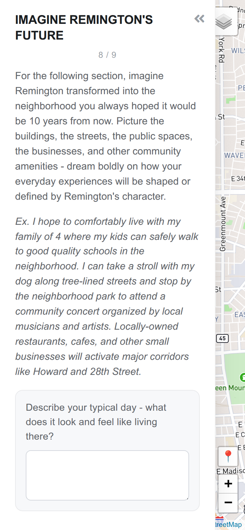
Nine pages, in English and Spanish. The first part is a questionnaire: who is answering, what a typical day in Remington looks and feels like, housing, businesses and culture, open space, getting around. One page asks residents to imagine the neighborhood ten years from now and describe it in their own words.
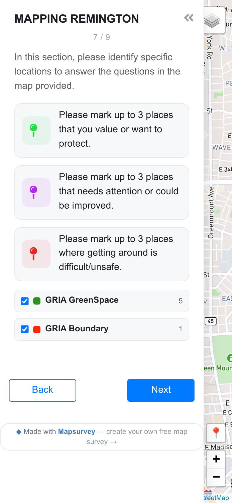
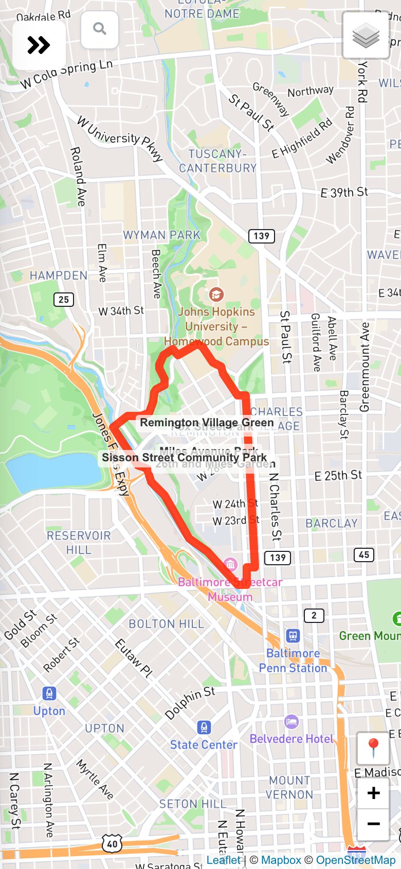
Then comes the map. The association's boundary and its green spaces are drawn on it, and residents answer three questions by placing up to three pins each: places they value or want to protect, places that need attention or could be improved, and places where getting around is difficult or unsafe. Every pin carries a short explanation.
Residents were invited with flyers carrying a QR code, posted around the neighborhood and shared by social media and email. Paper copies of the survey are also being handed out, to reach as many residents and community members as possible.
What residents told the planners
In the first three weeks, 146 residents answered and marked 717 places, seven in ten of them on a phone. Those who went through to the end needed about 18 minutes. The answers are the association's to publish with the plan; here is what they showed the planners first.
Four green places, by name
Asked for up to three places they value or want to protect, 86 residents placed 274 pins, and the pins cluster hard: seven spots take 156 of them, and the first four are all green. A park with its community garden, the village green beside the food hall, a playground and a creek trail. Residents do not value Remington's green space in general; they value four pieces of it, by name, and say so in their notes.
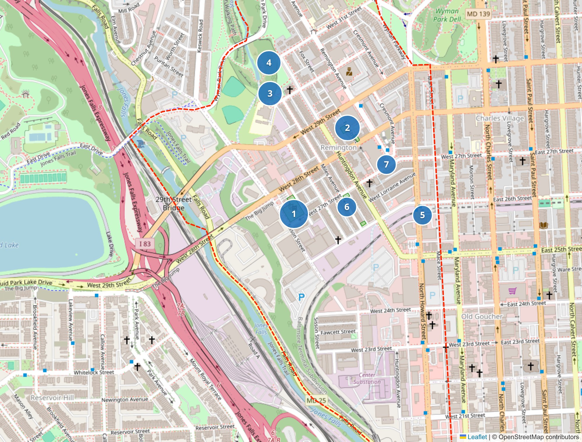
- Sisson Street Park and Community Garden 46 pins · 43 residents
"Sisson Park is a great urban park and I appreciate the balance between community garden, social gathering…" - R. House and the Remington Village Green 31 pins · 29 residents
"R House has become one of the heartbeats of the neighborhood." - The 29th Street playground 26 pins · 24 residents
"Love this park, would be great to have a covered seating area here!" - Stony Run trail and Wyman Park 23 pins · 21 residents
"Safe accessible access to Stony Run very important to us and our kids!"
One bridge
No single place gets more attention than the closed Sisson Street bridge over the rail cut, which used to join lower Remington to the rest of the neighborhood. It is the top "needs attention" spot and the second most "difficult to get around" spot: 39 pins sit on the bridge itself, 40 pin explanations mention it, and 32 of the longer written answers bring it up unprompted, in the question about what has changed, in the question about the future, in the final comments. Residents south of the cut describe being separated from the parks, shops and events everyone else is praising. Several add a condition: bring it back for people, not for cars.
"The closed bridge keeps us from connecting to the rest of the Remington community. A short walk turns into a longer one along the busy Howard St, or a car ride."
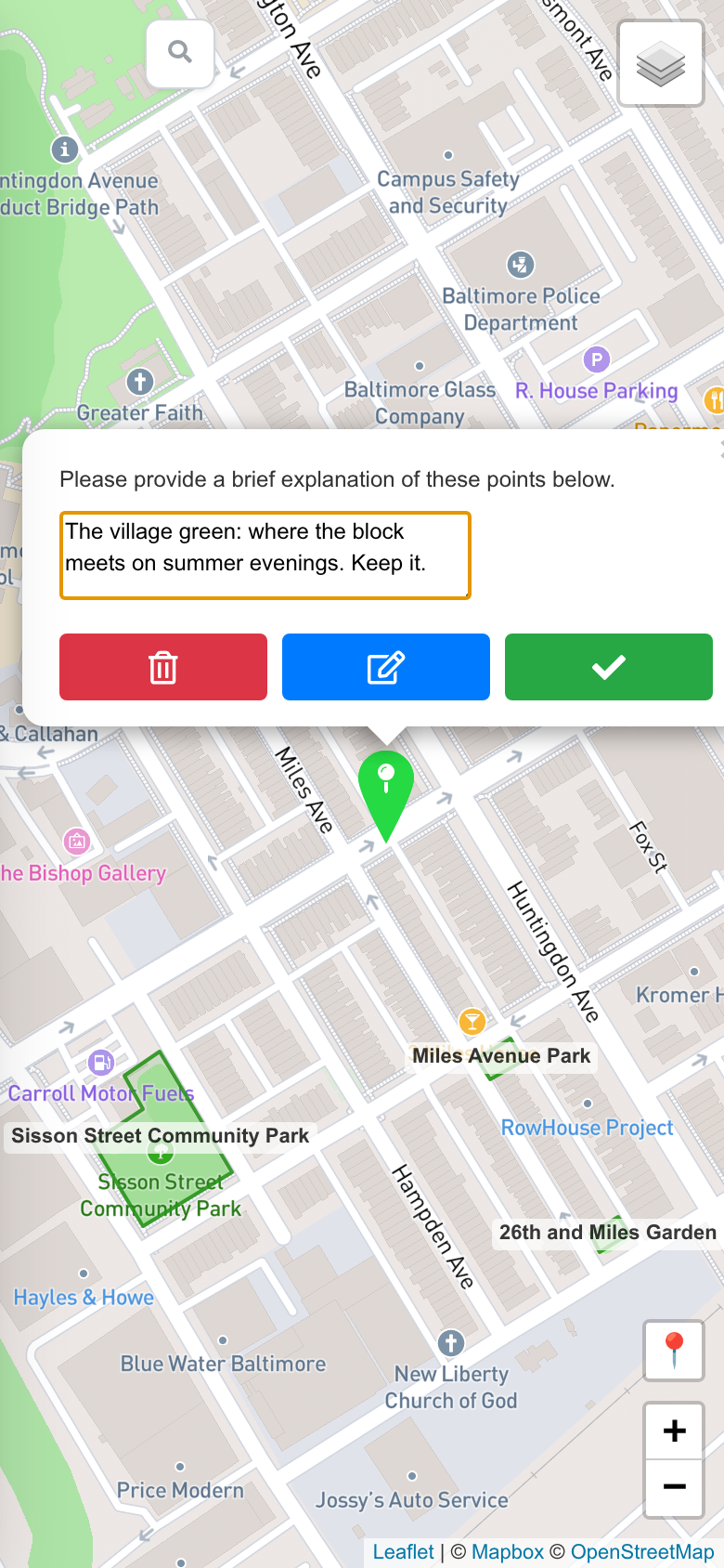
A pin on the bridge: where getting around is difficult
Six crossings
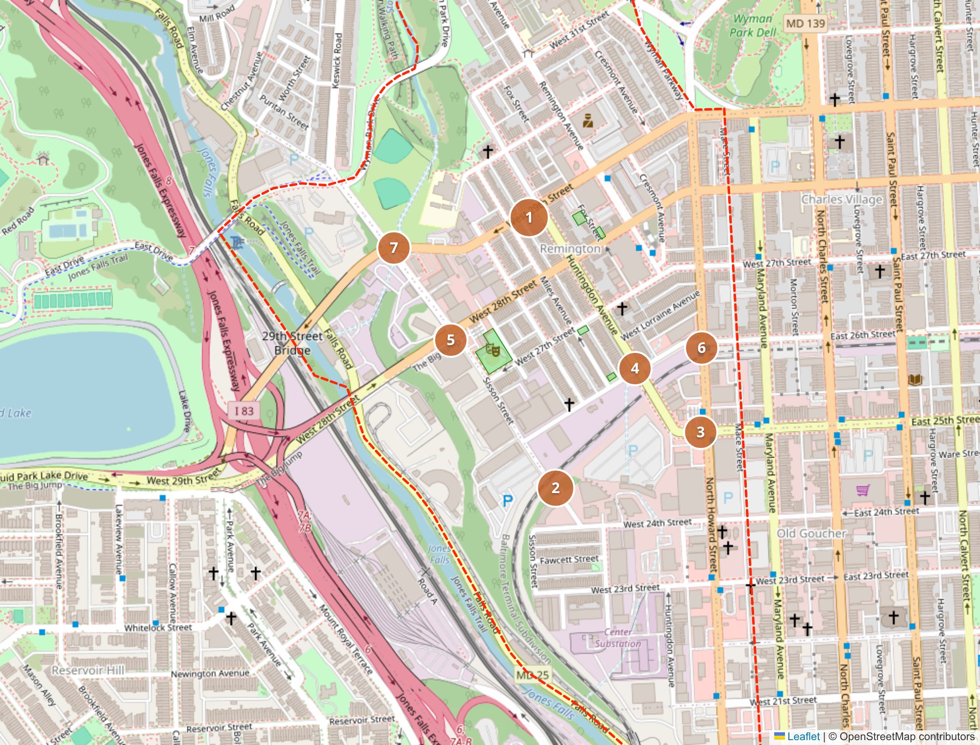
85 residents placed 214 pins where getting around is difficult or unsafe, and almost all of them sit on intersections. One crossing stands out: 29th Street at Huntingdon Avenue, 20 pins from 17 people with the same complaint in different words, cars turning fast across people who have the signal. Then the bridge, the crossings of Howard Street at 25th and 26th, the junction of 26th and Huntingdon that several ask to be made a four-way stop, and the ramps where 28th and 29th Streets meet the expressway.
People want to drive less than they do
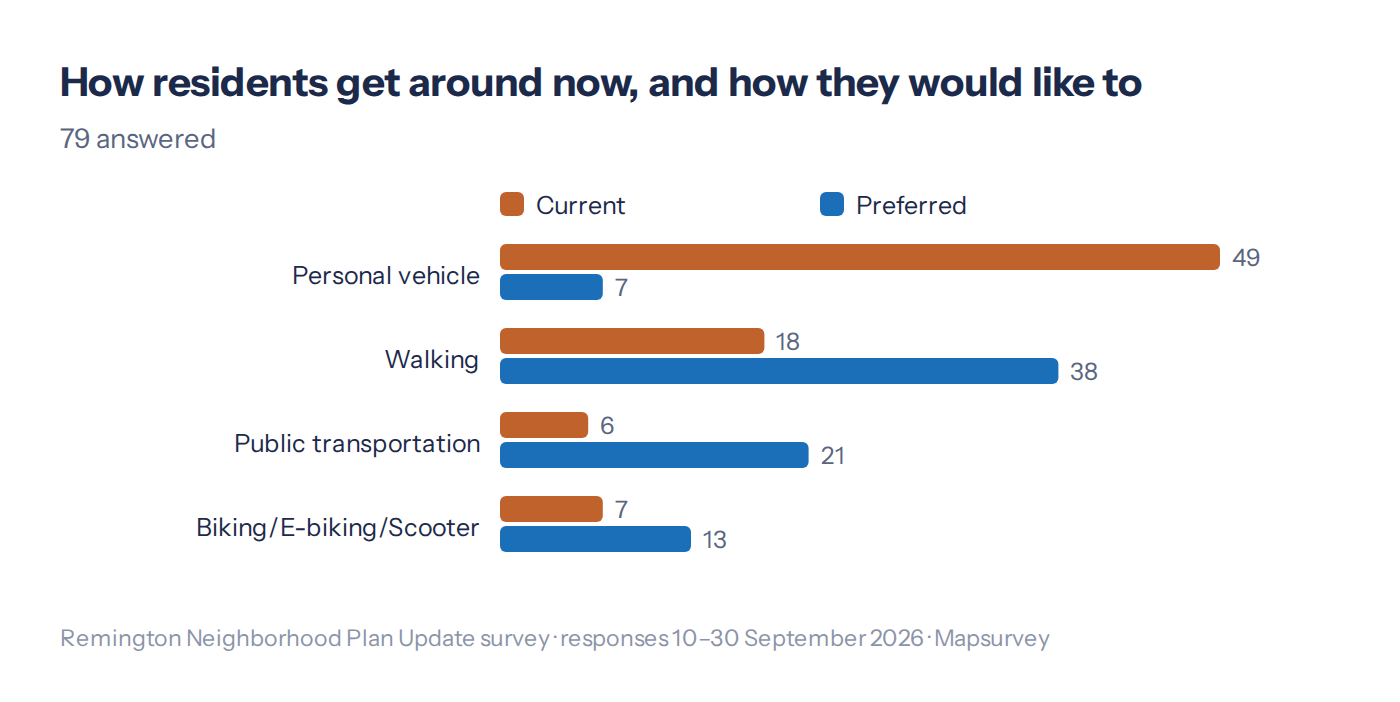
Two questions sit side by side in the survey: how do you get around today, and how would you like to. The answers do not match. 49 of 79 drive today; 7 would choose to. 38 would rather walk and 21 would rather take transit. The streets are built for the first answer, and residents' top asks for the plan follow from the second: traffic calming, crosswalks at the big intersections and resurfaced streets, each picked by a third or more.
And a grocery store
Asked to picture a typical day ten years from now, 115 residents wrote one, and they are remarkably alike: walk the kids to school, walk to a cafe and a grocery store, sit on the stoop under a tree, hear less traffic, meet neighbors at an event on the green. The grocery store deserves its own line. It is named in 33 of the visions, and when the survey asks separately what is missing, 44 of 63 answers put it first.
What's next
The survey stays open through October 2026. The answers go into the plan update; we will add a line here when the association publishes it.
Planning a count, a consultation or a survey like this one?
Draw your zones, write your questions and share one link. Free to start.
Create your map survey